Infrared Imaging
Infrared imaging on a rainy, windy day
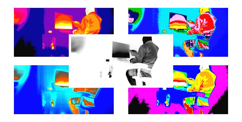
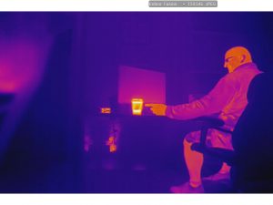
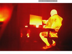
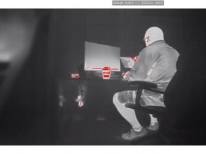
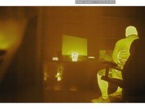
So what does an infrared drone guy do on a rainy windy day... practice. Happily Flir in conjunction with DJI has upgraded their camera and software to give so many more options. All the colors and palettes become more vivid and dynamic. You can even tell how hot your cup of coffee is if you have your drone fired up and running (no propellers) and facing yourself. The Starbucks coffee was 140 degrees when I first set it on the desk. Within the first 10 minutes it decreased 20 degrees. Enough about coffee.
 Infrared Drone Uses
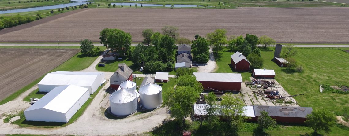
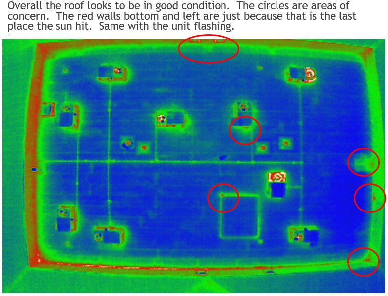
The use of drones and infrared imaging are growing. A lot of people don't even realize how useful it can be. I recently had my DJI Inspire Pro with the XT Flir camera flying over a commercial building. Now I didn't know were the leaks on the building were, but after careful examination I circled areas of concern on the infrared and presented this to the owner. Surprise surprise the areas that I circled on the infrared turned out to be close to the leak areas on the building. Now the owner is educated about his roof leaks on his building and a roofing contractor can come out and accurately repair the roof.
Infrared Drone Uses
The use of drones and infrared imaging are growing. A lot of people don't even realize how useful it can be. I recently had my DJI Inspire Pro with the XT Flir camera flying over a commercial building. Now I didn't know were the leaks on the building were, but after careful examination I circled areas of concern on the infrared and presented this to the owner. Surprise surprise the areas that I circled on the infrared turned out to be close to the leak areas on the building. Now the owner is educated about his roof leaks on his building and a roofing contractor can come out and accurately repair the roof.
 Hvac contractors can use infrared to see how hot the units are running and believe me some run very hot compared to others (see picture above, two units running hotter).
Electric companies can inspect transformers and any other part of the electrical systems to find out what is operating inefficiently. Any type of piping that runs on the outside of a building can be inspected.
Cellular towers can be inspected.
Search and rescue, especially at night reveal vivid pictures of human being trying to hide or run from something.
The energy efficiency of any building can be determined.
Hvac contractors can use infrared to see how hot the units are running and believe me some run very hot compared to others (see picture above, two units running hotter).
Electric companies can inspect transformers and any other part of the electrical systems to find out what is operating inefficiently. Any type of piping that runs on the outside of a building can be inspected.
Cellular towers can be inspected.
Search and rescue, especially at night reveal vivid pictures of human being trying to hide or run from something.
The energy efficiency of any building can be determined.
 Infrared Drone Uses
The use of drones and infrared imaging are growing. A lot of people don't even realize how useful it can be. I recently had my DJI Inspire Pro with the XT Flir camera flying over a commercial building. Now I didn't know were the leaks on the building were, but after careful examination I circled areas of concern on the infrared and presented this to the owner. Surprise surprise the areas that I circled on the infrared turned out to be close to the leak areas on the building. Now the owner is educated about his roof leaks on his building and a roofing contractor can come out and accurately repair the roof.
Infrared Drone Uses
The use of drones and infrared imaging are growing. A lot of people don't even realize how useful it can be. I recently had my DJI Inspire Pro with the XT Flir camera flying over a commercial building. Now I didn't know were the leaks on the building were, but after careful examination I circled areas of concern on the infrared and presented this to the owner. Surprise surprise the areas that I circled on the infrared turned out to be close to the leak areas on the building. Now the owner is educated about his roof leaks on his building and a roofing contractor can come out and accurately repair the roof.
 Hvac contractors can use infrared to see how hot the units are running and believe me some run very hot compared to others (see picture above, two units running hotter).
Electric companies can inspect transformers and any other part of the electrical systems to find out what is operating inefficiently. Any type of piping that runs on the outside of a building can be inspected.
Cellular towers can be inspected.
Search and rescue, especially at night reveal vivid pictures of human being trying to hide or run from something.
The energy efficiency of any building can be determined.
Hvac contractors can use infrared to see how hot the units are running and believe me some run very hot compared to others (see picture above, two units running hotter).
Electric companies can inspect transformers and any other part of the electrical systems to find out what is operating inefficiently. Any type of piping that runs on the outside of a building can be inspected.
Cellular towers can be inspected.
Search and rescue, especially at night reveal vivid pictures of human being trying to hide or run from something.
The energy efficiency of any building can be determined.